November 14, 2014
Big Holes

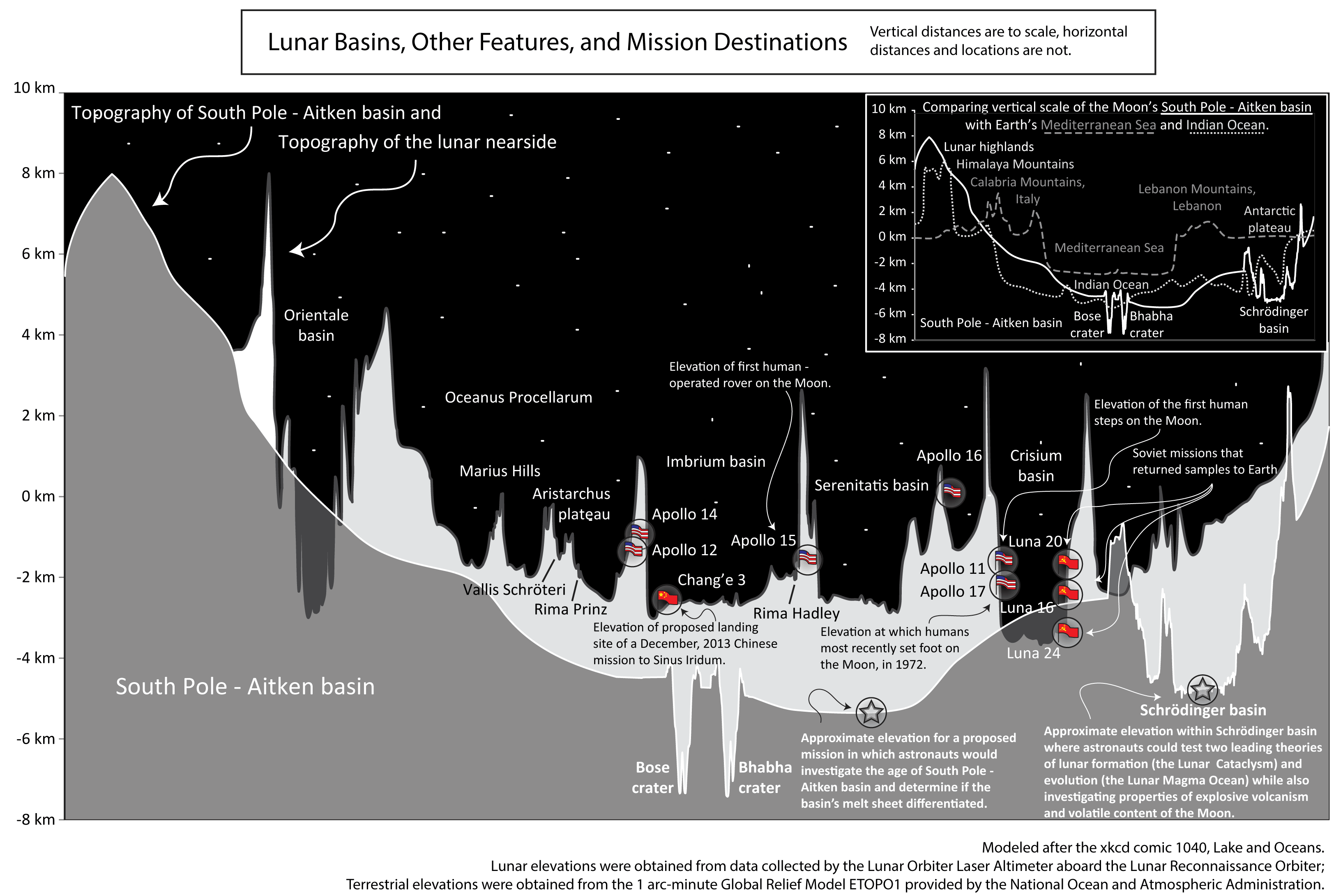
image by Debra M. Hurwitz (LPI)
The Lunar and Planetary Institute in Houston has developed a large collection of illustrations that might be of value whenever any of you (or I) prepare a presentation about the Moon. Many of the drawings and images concern impact cratering, volcanism, petrology, and the structure of the Moon, but I selected this one just because it is unusual. It shows topographic transects across various lunar landforms combined on one diagram. The bottommost, gray area is a cross-section of the South Pole-Aitken Basin, with the high elevation of 8 km above the average lunar radius being the north rim of the basin near the center of the far side. The deepest part of the SPA at -5 km is about 13 km below the high parts of the rim - its a big hole. Superposed on the SPA transect is a light colored one that shows the elevations of a few nearside basins and other features. One thing that is clear is that the SPA is deeper and higher than any places on the nearside. This is sort of fun, but you can create your own transects of any part of the Moon by using the Line tool of LRO QuickMap. I find that it is wonderfully revealing to simply make a transect all around the equator. The nearside is on average about 3-4 km lower than the far side. Try it.
Chuck Wood
Yesterday's LPOD: Not Linda
Tomorrow's LPOD: Motion Sickness?
COMMENTS?
Register, Log in, and join in the comments.


