October 17, 2023
Planning a Trip
Originally published October 2, 2013

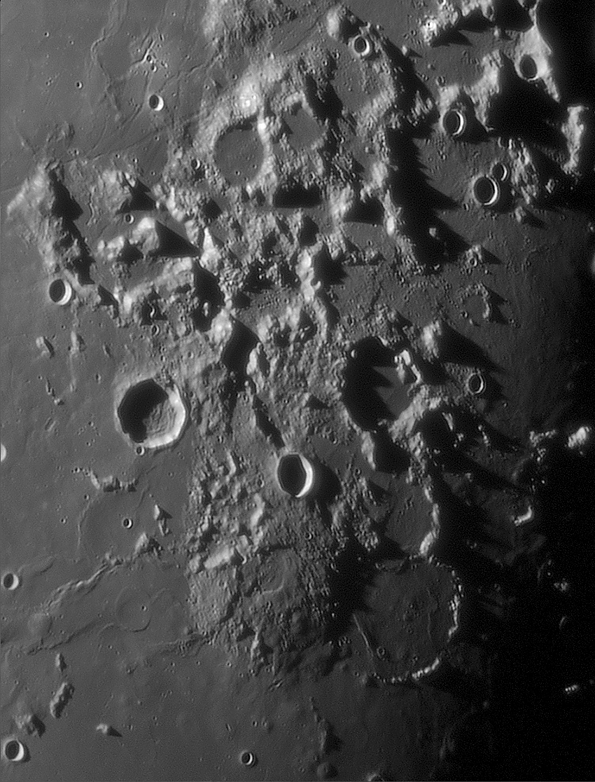
image by Jocelyn Serot, France
Imagine yourself at a point located exactly at the center of the image, in the middle of hilly terrain between Mt Vitruvius and Maraldi. You will be at an almost equal distance from two major sites: the Gardner mega-dome at south and the Apollo 17 landing site at north. Where would you go first if you had to choose? Going north, you could visit the LM left there by Schmidt and Cernan and then explore the rilles in the Taurus-Littrow valley (R. Carmen, R. Rudolf, just west of the small crater Ching-Te), or going farther north the complex network of rilles in the upper left corner of the image. Going south, I bet that wandering through the big caldera (?) of the mega-dôme would be an invaluable experience for a geologist. Climbing down the slopes of this huge dome would then bring you to a lot of smaller domes, which are here revealed by the lighting conditions. Indeed, the whole region is a complex and rich one and I can imagine deciding that choosing a target would be very difficult.
Jocelyn Serot
Technical Details
Sep 24, 2013, 05:30:38. C11.
Related Links
21st Century Atlas chart 8.
Continuing south
Yesterday's LPOD: West View
Tomorrow's LPOD: Part of an Unseeable Universe
COMMENTS?
Register, Log in, and join in the comments.


