Difference between revisions of "September 30, 2015"
(Created page with "__NOTOC__ =Mountains at the Pole= Originally published September 29, 2004 <!-- Start of content --> <table width="85%" border="0" align="center" cellpadding="6" cellspacing="...") |
(No difference)
|
Latest revision as of 00:05, 30 September 2015
Mountains at the Pole
Originally published September 29, 2004
Image Credit: Martin Fiedler |
|
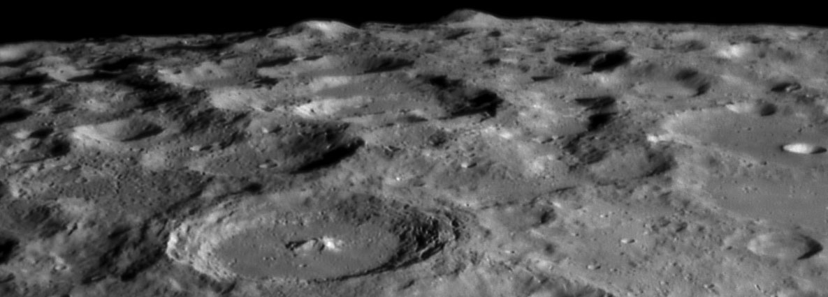
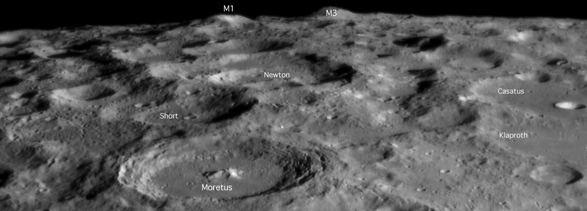
Mountains at the Pole The south pole region of the Moon is a dramatic cacophony of craters and peaks. Extreme foreshortening and rugged topography make navigation here difficult. And that is just for observers, wait until lunar prospectors try mining ice in future decades! But today we have a gorgeous new image of the region just Earthward of the pole. Starting with 114 km wide Moretus and extending south and a little west we see overlapping, older and mostly flat-floored craters. The two mountains on the horizon are among the taller peaks on the Moon. Following the informal nomenclature of Ewen Whitaker's classic 1954 map, peak M1 is just in front of the shadowed crater Cabeus, and M3 is slightly behind and east of the crater, and nearly at 90 degrees S latitude. Whitaker suggests that M1 rises 20,000 to 25,000 ft ( 6 - 7.5 km) above the general surface level, and M3 is slightly lower at 15,000 to 20,000 ft (4.5 - 6 km). Just beyond the pole (but visible with good illumination and libration) are two additional massive peaks, M4 and M5 (which rises to 30,000 ft - 9 km). These peaks used to be called the Leibnitz Mts, but the name was decommissioned by an IAU committee ignorant of the real Moon. All of these peaks are portions of the rim of the South Pole-Aitken basin - little bits of the largest feature on the farside, sometimes visible from Earth. Technical Details: Related Links: Yesterday's LPOD: Unknown Luna 19 Tomorrow's LPOD: Crisium Closeup |
|
Author & Editor: |
COMMENTS?
Register, Log in, and join in the comments.


