Difference between revisions of "May 17, 2013"
| (7 intermediate revisions by the same user not shown) | |||
| Line 1: | Line 1: | ||
__NOTOC__ | __NOTOC__ | ||
=Steps To the Pole= | =Steps To the Pole= | ||
| − | + | <!-- Start of content --> | |
<!-- ws:start:WikiTextHeadingRule:0:<h1> --> | <!-- ws:start:WikiTextHeadingRule:0:<h1> --> | ||
<!-- ws:start:WikiTextLocalImageRule:14:<img src="/file/view/LPOD-May17-13.jpg/432237562/LPOD-May17-13.jpg" alt="" title="" /> -->[[File:LPOD-May17-13.jpg|LPOD-May17-13.jpg]]<!-- ws:end:WikiTextLocalImageRule:14 --><br /> | <!-- ws:start:WikiTextLocalImageRule:14:<img src="/file/view/LPOD-May17-13.jpg/432237562/LPOD-May17-13.jpg" alt="" title="" /> -->[[File:LPOD-May17-13.jpg|LPOD-May17-13.jpg]]<!-- ws:end:WikiTextLocalImageRule:14 --><br /> | ||
| Line 14: | Line 14: | ||
<br /> | <br /> | ||
<strong>Related Links</strong><br /> | <strong>Related Links</strong><br /> | ||
| − | Rükl plate [ | + | Rükl plate [https://the-moon.us/wiki/R%C3%BCkl_4 4]<br /> |
| − | <em>[ | + | <em>[[21st Century Atlas of the Moon|21st Century Atlas]]</em> charts 10 & L8.<br /> |
</td> | </td> | ||
</tr> | </tr> | ||
</table> | </table> | ||
<br /> | <br /> | ||
| + | <p><b>Yesterday's LPOD:</b> [[May 16, 2013|Lonesome Chain]] </p> | ||
| + | <p><b>Tomorrow's LPOD:</b> [[May 18, 2013|Imbrium Flasher]] </p> | ||
<hr /> | <hr /> | ||
| + | {{wiki/ArticleFooter}} | ||
Latest revision as of 07:32, 28 October 2018
Steps To the Pole

image by Howard Eskildsen
 |
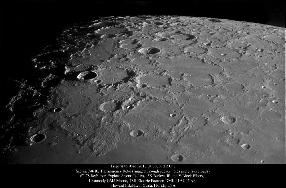
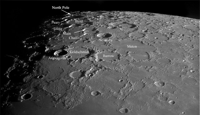
At first, the northern portion of the Moon appears battered and confusing, but finding just a few key craters can bring order to the chaos and lead the observer to the lunar North Pole. Battered Barrow lies between Goldschmidt and the mega-complex, Meton. Beyond Barrow, the fresh crater Scoresby leads the way to the pole with steps through Challis, Main, Byrd, and finally Peary. The pole lies on the upper rim of Peary in this image, and the highlands visible between the pole and the upper margin of the image mark the region that I like to refer to as "south of north." Once you visualize the northern trail of craters that lead to the pole, it becomes easy to get your bearings in the north polar region. Notice the shadowed Anaxagoras on the western margin of Goldschmidt and Gioja (pronounced Geo-ee´-a). Anaxagoras is a young crater with rays extending across the mid-portion of the photo, while Gioja is another tired, worn crater clinging to the margin of Byrd.
|
Yesterday's LPOD: Lonesome Chain
Tomorrow's LPOD: Imbrium Flasher
COMMENTS?
Register, Log in, and join in the comments.


