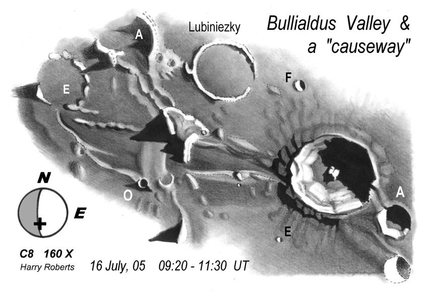
drawing by Harry Roberts
Maria are not flat, they drape underlying features, smoothing them out, making detection and interpretation difficult. That is why its fun looking near the terminator when it is near a mare surface. Harry became fascinated with features on, under? above? Mare Nubium west of Bullialdus. He notes a causeway (on Earth an elevated passageway) and wondered what caused it. Rükl noted the causeway in his Atlas of the Moon and a number of observers have commented on it, but what is it? The first thing to note is that the causeway seems to span a broad linear depression that strangely has a designation: Bullialdus W. Lunar Orbiter IV shows that this trough is bounded on both sides by low mare ridges which define the linear area, but there could be no actual depression. A Consolidated Lunar Atlas image suggests that the south (bottom) side of the trough is actually a broad, flattish mare ridge. By now you may have forgotten about the causeway, which is good, because I have no idea what it is.
Technical Details:
16 July 2005. C8 at 160X. See the Feb 1 LPOD for a description of Harry’s artistic techniques.
Related Links:
Rükl chart 53
Consolidated Lunar Atlas view
Now you can support LPOD when you buy ANY book from Amazon thru LPOD!
COMMENTS?
Register, and click on the Discussion tab at the top of the page.


