September 28, 2020
Quick, Here is the Map
Originally published March 24, 2011

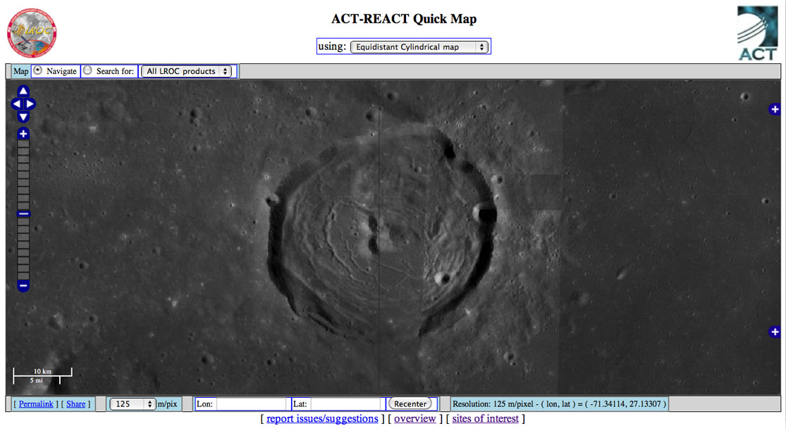
image from LROC
The Lunar Reconnaissance Orbiter Camera team has released another tool to access
and display wide angle and narrow angle camera images. QuickMap is a global map -
equidistant cylindrical, and orthographic for the poles - with overlays for WAC and NAC
images. The red image outlines are a nuisance (until you need them) and so the first
thing I do is click the plus sign at upper right to turn them off, and then hit the minus at
bottom right to turn off the index map. Double clicking anywhere on the map will zoom
in to double the resolution. A Google Maps clickable scale on the left allows clicking up
or down to any desired scale from 32 km/pi to 0.5 m/pi.. Once you enlarge to 32 m/pixel
the NAC images are overlaid on the WAC mosaic. At any scale you can overlay the
LOLA altimetry coloration, making it very easy to compare morphology with topography.
I couldn't find a scale for the topo overlay - it would be fantastic to be able to click any
point to determine its elevation, just as lat/long is displayed for every location. The LROC
team solicits suggestions. In addition to the elevation scale one, I think it would be very
useful to have a distance measuring tool, for finding the diameters of craters or boulders,
and to determine the lengths of rilles and ridges. Another capability that would be quite
useful would be for feature names to appear as the cursor is moved over features. This
would be especially valuable for the farside, that I at least, know much less well than the
nearside. QuickMap is another very valuable tool that I will use frequently. Thanks to the
LROC team for providing it.
Chuck Wood
P.S.: Notice anything odd about the image above? It was mosaicked together using images
illuminated from both directions. I can't tell you the name of the crater because I'd have
to drag out an atlas or start another program to access that information.
Yesterday's LPOD: Come Out On the Balcony for a Better View
Tomorrow's LPOD: Hello From the Universe
COMMENTS?
Register, Log in, and join in the comments.


