February 27, 2020
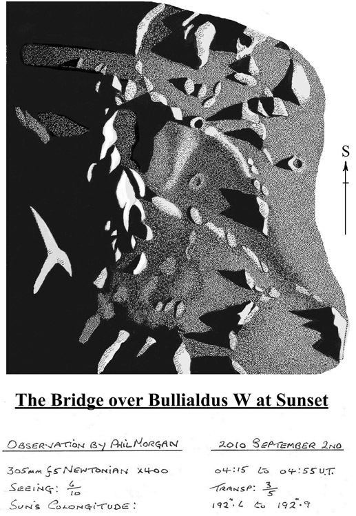
Bridge Near Bullialdus
Originally published September 15, 2010
 image by Philip Morgan |
Running in a northwesterly direction from the outer flank of the crater Bullialdus is a wide flat graben/valley some 20 km in width and about 90 km long. Midway along the valley floor is a peculiar flat topped 10 km wide wall that effectively dams the floor of the valley, which under some lighting conditions can be mistaken for a bridge. Finding a convincing explanation for this little feature is difficult, but presumably when the valley floor of Bullialdus W subsided, the crustal material of the bridge was more resistant to the downward movement of material, possibly because it is the surface expression of a magmatic intrusion, i.e. a dyke or horst. Interestingly, and as my recent observation shows, the bridge is actually slightly thicker at its upside or (southwestern) end rather than at its base. Could this be due to a downward (northerleasterly) flow of material in the valley floor? Situated just a little way to the east of the bridge a curving mountain arm also spans the valley floor, though whether or not this is just the remnant of a once perfect crater rampart is difficult to say.
|
Yesterday's LPOD: Seeing More At Wargentin
Tomorrow's LPOD: Saturday's Moon Maddness
COMMENTS?
Register, Log in, and join in the comments.


